7 2024 Road Trip - Day 20
Craters of the Moon National Monument and Preserve is a U.S. national monument and national preserve in the Snake River Plain in central Idaho. It is along US 20 (concurrent with US 93 and US 26), between the small towns of Arco and Carey, at an average elevation of 5,900 feet (1,800 m) above sea level.
The Monument was established on May 2, 1924. In November 2000, a presidential proclamation by President Clinton greatly expanded the Monument area. The 410,000-acre National Park Service portions of the expanded Monument were designated as Craters of the Moon National Preserve in August 2002. It spreads across Blaine, Butte, Lincoln, Minidoka, and Power counties. The area is managed cooperatively by the National Park Service and the Bureau of Land Management (BLM).
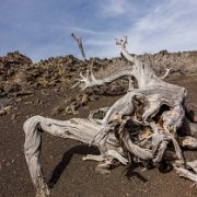
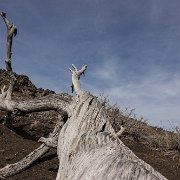
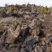
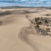
The Monument and Preserve encompass three major lava fields and about 400 square miles (1,000 km2) of sagebrush steppe grasslands to cover a total area of 1,117 square miles (2,893 km2). The Monument alone covers 343,000 acres (139,000 ha).[5] All three lava fields lie along the Great Rift of Idaho, with some of the best examples of open rift cracks in the world, including the deepest known on Earth at 800 feet (240 m). There are excellent examples of almost every variety of basaltic lava, as well as tree molds (cavities left by lava-incinerated trees), lava tubes (a type of cave), and many other volcanic features.

8 2024 Road Trip - Day 20
Craters of the Moon National Monument and Preserve is a U.S. national monument and national preserve in the Snake River Plain in central Idaho. It is along US 20 (concurrent with US 93 and US 26), between the small towns of Arco and Carey, at an average elevation of 5,900 feet (1,800 m) above sea level.
The Monument was established on May 2, 1924. In November 2000, a presidential proclamation by President Clinton greatly expanded the Monument area. The 410,000-acre National Park Service portions of the expanded Monument were designated as Craters of the Moon National Preserve in August 2002. It spreads across Blaine, Butte, Lincoln, Minidoka, and Power counties. The area is managed cooperatively by the National Park Service and the Bureau of Land Management (BLM).
The Monument and Preserve encompass three major lava fields and about 400 square miles (1,000 km2) of sagebrush steppe grasslands to cover a total area of 1,117 square miles (2,893 km2). The Monument alone covers 343,000 acres (139,000 ha).[5] All three lava fields lie along the Great Rift of Idaho, with some of the best examples of open rift cracks in the world, including the deepest known on Earth at 800 feet (240 m). There are excellent examples of almost every variety of basaltic lava, as well as tree molds (cavities left by lava-incinerated trees), lava tubes (a type of cave), and many other volcanic features.
9 2024 Road Trip - Day 20
Craters of the Moon National Monument and Preserve is a U.S. national monument and national preserve in the Snake River Plain in central Idaho. It is along US 20 (concurrent with US 93 and US 26), between the small towns of Arco and Carey, at an average elevation of 5,900 feet (1,800 m) above sea level.
The Monument was established on May 2, 1924. In November 2000, a presidential proclamation by President Clinton greatly expanded the Monument area. The 410,000-acre National Park Service portions of the expanded Monument were designated as Craters of the Moon National Preserve in August 2002. It spreads across Blaine, Butte, Lincoln, Minidoka, and Power counties. The area is managed cooperatively by the National Park Service and the Bureau of Land Management (BLM).
The Monument and Preserve encompass three major lava fields and about 400 square miles (1,000 km2) of sagebrush steppe grasslands to cover a total area of 1,117 square miles (2,893 km2). The Monument alone covers 343,000 acres (139,000 ha).[5] All three lava fields lie along the Great Rift of Idaho, with some of the best examples of open rift cracks in the world, including the deepest known on Earth at 800 feet (240 m). There are excellent examples of almost every variety of basaltic lava, as well as tree molds (cavities left by lava-incinerated trees), lava tubes (a type of cave), and many other volcanic features.
10 2024 Road Trip - Day 20
Craters of the Moon National Monument and Preserve is a U.S. national monument and national preserve in the Snake River Plain in central Idaho. It is along US 20 (concurrent with US 93 and US 26), between the small towns of Arco and Carey, at an average elevation of 5,900 feet (1,800 m) above sea level.
The Monument was established on May 2, 1924. In November 2000, a presidential proclamation by President Clinton greatly expanded the Monument area. The 410,000-acre National Park Service portions of the expanded Monument were designated as Craters of the Moon National Preserve in August 2002. It spreads across Blaine, Butte, Lincoln, Minidoka, and Power counties. The area is managed cooperatively by the National Park Service and the Bureau of Land Management (BLM).
The Monument and Preserve encompass three major lava fields and about 400 square miles (1,000 km2) of sagebrush steppe grasslands to cover a total area of 1,117 square miles (2,893 km2). The Monument alone covers 343,000 acres (139,000 ha).[5] All three lava fields lie along the Great Rift of Idaho, with some of the best examples of open rift cracks in the world, including the deepest known on Earth at 800 feet (240 m). There are excellent examples of almost every variety of basaltic lava, as well as tree molds (cavities left by lava-incinerated trees), lava tubes (a type of cave), and many other volcanic features.

11 2024 Road Trip - Day 20
Craters of the Moon National Monument and Preserve is a U.S. national monument and national preserve in the Snake River Plain in central Idaho. It is along US 20 (concurrent with US 93 and US 26), between the small towns of Arco and Carey, at an average elevation of 5,900 feet (1,800 m) above sea level.
The Monument was established on May 2, 1924. In November 2000, a presidential proclamation by President Clinton greatly expanded the Monument area. The 410,000-acre National Park Service portions of the expanded Monument were designated as Craters of the Moon National Preserve in August 2002. It spreads across Blaine, Butte, Lincoln, Minidoka, and Power counties. The area is managed cooperatively by the National Park Service and the Bureau of Land Management (BLM).
The Monument and Preserve encompass three major lava fields and about 400 square miles (1,000 km2) of sagebrush steppe grasslands to cover a total area of 1,117 square miles (2,893 km2). The Monument alone covers 343,000 acres (139,000 ha).[5] All three lava fields lie along the Great Rift of Idaho, with some of the best examples of open rift cracks in the world, including the deepest known on Earth at 800 feet (240 m). There are excellent examples of almost every variety of basaltic lava, as well as tree molds (cavities left by lava-incinerated trees), lava tubes (a type of cave), and many other volcanic features.

17 2024 Road Trip - Day 20
Base Jumping
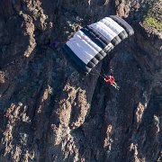
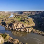
The Perrine Memorial Bridge, an iconic structure in Twin Falls, Idaho, has a rich history that dates back to its original construction in 1927. Named after Ira Burton Perrine, a key figure in the region's agricultural development, the bridge was initially built to connect the city of Twin Falls with the surrounding areas, fostering economic growth and development. The original bridge was a steel cantilever design, which was a common choice for large spans during that era. However, by the 1970s, the old bridge had become insufficient for modern traffic demands and safety standards, leading to the decision to replace it with a new structure.
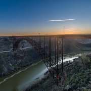
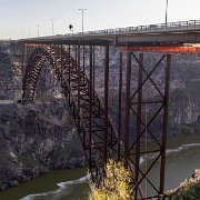
The construction of the current Perrine Memorial Bridge began in 1973 and was completed in 1976. This modern iteration is a steel arch bridge, notable for its impressive engineering and elegant design. The bridge spans 1,500 feet across the majestic Snake River Canyon, with a main span of 993 feet and a towering height of 486 feet above the canyon floor. The steel arch design not only provides the necessary strength and durability but also creates a visually striking silhouette against the natural backdrop. The bridge's architecture reflects a blend of functionality and aesthetic appeal, showcasing advancements in engineering and construction techniques of the time.

18 2024 Road Trip - Day 20
Base Jumping
The Perrine Memorial Bridge, an iconic structure in Twin Falls, Idaho, has a rich history that dates back to its original construction in 1927. Named after Ira Burton Perrine, a key figure in the region's agricultural development, the bridge was initially built to connect the city of Twin Falls with the surrounding areas, fostering economic growth and development. The original bridge was a steel cantilever design, which was a common choice for large spans during that era. However, by the 1970s, the old bridge had become insufficient for modern traffic demands and safety standards, leading to the decision to replace it with a new structure.
The construction of the current Perrine Memorial Bridge began in 1973 and was completed in 1976. This modern iteration is a steel arch bridge, notable for its impressive engineering and elegant design. The bridge spans 1,500 feet across the majestic Snake River Canyon, with a main span of 993 feet and a towering height of 486 feet above the canyon floor. The steel arch design not only provides the necessary strength and durability but also creates a visually striking silhouette against the natural backdrop. The bridge's architecture reflects a blend of functionality and aesthetic appeal, showcasing advancements in engineering and construction techniques of the time.

19 2024 Road Trip - Day 20
Base Jumping
The Perrine Memorial Bridge, an iconic structure in Twin Falls, Idaho, has a rich history that dates back to its original construction in 1927. Named after Ira Burton Perrine, a key figure in the region's agricultural development, the bridge was initially built to connect the city of Twin Falls with the surrounding areas, fostering economic growth and development. The original bridge was a steel cantilever design, which was a common choice for large spans during that era. However, by the 1970s, the old bridge had become insufficient for modern traffic demands and safety standards, leading to the decision to replace it with a new structure.
The construction of the current Perrine Memorial Bridge began in 1973 and was completed in 1976. This modern iteration is a steel arch bridge, notable for its impressive engineering and elegant design. The bridge spans 1,500 feet across the majestic Snake River Canyon, with a main span of 993 feet and a towering height of 486 feet above the canyon floor. The steel arch design not only provides the necessary strength and durability but also creates a visually striking silhouette against the natural backdrop. The bridge's architecture reflects a blend of functionality and aesthetic appeal, showcasing advancements in engineering and construction techniques of the time.
20 2024 Road Trip - Day 20
Base Jumping
The Perrine Memorial Bridge, an iconic structure in Twin Falls, Idaho, has a rich history that dates back to its original construction in 1927. Named after Ira Burton Perrine, a key figure in the region's agricultural development, the bridge was initially built to connect the city of Twin Falls with the surrounding areas, fostering economic growth and development. The original bridge was a steel cantilever design, which was a common choice for large spans during that era. However, by the 1970s, the old bridge had become insufficient for modern traffic demands and safety standards, leading to the decision to replace it with a new structure.
The construction of the current Perrine Memorial Bridge began in 1973 and was completed in 1976. This modern iteration is a steel arch bridge, notable for its impressive engineering and elegant design. The bridge spans 1,500 feet across the majestic Snake River Canyon, with a main span of 993 feet and a towering height of 486 feet above the canyon floor. The steel arch design not only provides the necessary strength and durability but also creates a visually striking silhouette against the natural backdrop. The bridge's architecture reflects a blend of functionality and aesthetic appeal, showcasing advancements in engineering and construction techniques of the time.




Idaho