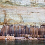
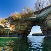
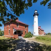
Pictured Rocks National Lakeshore 7/1/12—6/11/25

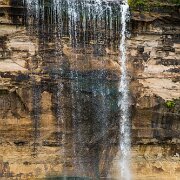
2012-07-01_15-31_04779_WTA_5DM3 Sable Falls is a waterfall located on Sable Creek in the eastern-most portion of the Pictured Rocks National Lakeshore in Alger County, Michigan. The falls...
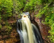
1 Sable Falls is a waterfall located on Sable Creek in the eastern-most portion of the Pictured Rocks National Lakeshore in Alger County, Michigan. The falls tumbles 75 feet over Munising and Jacobsville sandstone formations. The waterfall is approximately one-half mile from Lake Superior.
WTA_5DM3 - 2012_07_01 - 0912-Edit-2 Sable Falls is a waterfall located on Sable Creek in the eastern-most portion of the Pictured Rocks National Lakeshore in Alger County, Michigan. The falls...
2 Sable Falls is a waterfall located on Sable Creek in the eastern-most portion of the Pictured Rocks National Lakeshore in Alger County, Michigan. The falls tumbles 75 feet over Munising and Jacobsville sandstone formations. The waterfall is approximately one-half mile from Lake Superior.
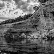
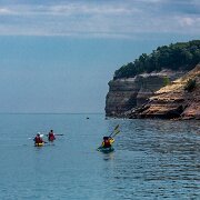
2012-07-02_09-23_05031_WTA_5DM3 Pictured Rocks National Lakeshore, Michigan
3 Pictured Rocks National Lakeshore, Michigan
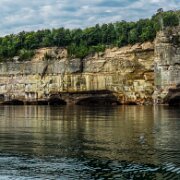
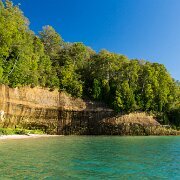
2012-07-02_09-28_05094_WTA_5DM3 Pictured Rocks National Lakeshore, Michigan
4 Pictured Rocks National Lakeshore, Michigan
WTA_5DM3 - 2012_07_02 - 0116-Edit-2 Pictured Rocks National Lakeshore, Michigan
5 Pictured Rocks National Lakeshore, Michigan
2012-07-02_09-59_05286_WTA_5DM3
6
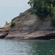
2012-07-02_10-13_05311_WTA_5DM3 Pictured Rocks National Lakeshore, Michigan
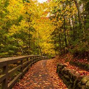
7 Pictured Rocks National Lakeshore, Michigan
2012-07-02_11-22_05665_WTA_5DM3 Pictured Rocks National Lakeshore, Michigan
8 Pictured Rocks National Lakeshore, Michigan
2012-07-02_11-25_05712_WTA_5DM3 Pictured Rocks National Lakeshore, Michigan
9 Pictured Rocks National Lakeshore, Michigan
2012-07-02_11-26_05721_WTA_5DM3 Pictured Rocks National Lakeshore, Michigan
10 Pictured Rocks National Lakeshore, Michigan
2012-07-02_11-26_05724_WTA_5DM3
11
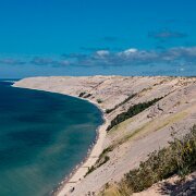
2012-08-27_16-02_09161_WTA_5DM3 Grand Sable Dunes cover a 5-mile stretch along the southern shore of Lake Superior in the upper peninsula of Michigan in the eastern portion of the Pictured...
12 Grand Sable Dunes cover a 5-mile stretch along the southern shore of Lake Superior in the upper peninsula of Michigan in the eastern portion of the Pictured Rocks National Lakeshore.
Glacial melt during the last major advance/retreat called the Marquette Readvance created the conditions for the formation of the Grand Sable Banks. Dominant northwesterly winds eventually caused blowing sand to become perched on the banks. Today, the Grand Sable Banks rise to heights of up to 300 ft. at a 35 degree angle from the shore of Lake Superior. The Grand Sable Dunes perched on top of these banks offers a desolate sandscape with jack pine forest near the edges.
2012-08-28_09-59_09301_WTA_5DM3 Pictured Rocks National Lakeshore is a U.S. National Lakeshore on the shore of Lake Superior in the Upper Peninsula of Michigan, United States. It extends for...
13 Pictured Rocks National Lakeshore is a U.S. National Lakeshore on the shore of Lake Superior in the Upper Peninsula of Michigan, United States. It extends for 42 miles (67 km) along the shore and covers 73,236 acres (114 sq mi; 296 km2).
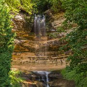
2012-08-28_16-24_09466_WTA_5DM3 Munising Falls is a waterfall located in Munising in the western-most portion of the Pictured Rocks National Lakeshore in Alger County. The falls drops about 50...
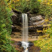
14 Munising Falls is a waterfall located in Munising in the western-most portion of the Pictured Rocks National Lakeshore in Alger County. The falls drops about 50 feet (15 m) over a sandstone cliff. With the exception of the spring thaw, the amount of water falling is relatively small. There are trails leading to multiple viewpoints around the falls.
In the winter, the falls freeze forming an ice column. Munising Falls themselves are off-limits to climbers, but ice climbing is popular in the area and there are other spots in the vicinity where climbing is allowed
2012-08-28_16-34_09493_WTA_5DM3
15
2014-10-09_56373_WTA_5DM3
16
2014-10-09_56419_WTA_5DM3-2 Munising Falls is a waterfall located in Munising in the westernmost portion of the Pictured Rocks National Lakeshore in Alger County. The falls drops about 50...
17 Munising Falls is a waterfall located in Munising in the westernmost portion of the Pictured Rocks National Lakeshore in Alger County. The falls drops about 50 feet (15 m) over a sandstone cliff. With the exception of the spring thaw, the amount of water falling is relatively small. There are trails leading to multiple viewpoints around the falls.
In the winter, the falls freeze forming an ice column. Munising Falls themselves are off-limits to climbers, but ice climbing is popular in the area and there are other spots in the vicinity where climbing is allowed
2014-10-09_56419_WTA_5DM3 Munising Falls is a waterfall located in Munising in the westernmost portion of the Pictured Rocks National Lakeshore in Alger County. The falls drops about 50...
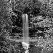
18 Munising Falls is a waterfall located in Munising in the westernmost portion of the Pictured Rocks National Lakeshore in Alger County. The falls drops about 50 feet (15 m) over a sandstone cliff. With the exception of the spring thaw, the amount of water falling is relatively small. There are trails leading to multiple viewpoints around the falls.
In the winter, the falls freeze forming an ice column. Munising Falls themselves are off-limits to climbers, but ice climbing is popular in the area and there are other spots in the vicinity where climbing is allowed
2014-10-09_56440_WTA_5DM3
19
2014-10-09_56462_WTA_5DM3
20

New images