Upper Peninsula 8/5/08—6/12/25

IMG_20080805_0639-Edit-2 Vermilion Point is a remote, undeveloped shore with a rich history lying 9.75 miles (15.69 km) west of Whitefish Point, Michigan, on a stretch of Lake...
1 Vermilion Point is a remote, undeveloped shore with a rich history lying 9.75 miles (15.69 km) west of Whitefish Point, Michigan, on a stretch of Lake Superior’s southeast coast known as the "Graveyard of the Great Lakes" or, in the title of a book by noted Great Lakes maritime historian Frederick Stonehouse, "The Shipwreck Coast". The servicemen of Vermilion Lifesaving Station performed daring rescues of shipwrecks from 1877 until 1944 when it was closed after modern navigational technology made this service obsolete.
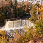
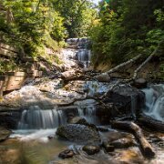
2008-08-05_25473_WTA_5DM1 Tahquamenon Falls, Michigan
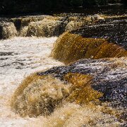
2 Tahquamenon Falls, Michigan
IMG_2011_02_10 - 0378-2
3
WTA_IMG_2011_10_11 - 0640-bw-2 The Granary, Brimley Michigan
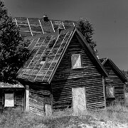
4 The Granary, Brimley Michigan
2011-10-11_14-12_15941_WTA_5DM2 The Granary - Brimley, Michigan
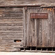
5 The Granary - Brimley, Michigan
2011-10-11_14-44_16058_WTA_5DM2 Brimley Scenic Overlook Panorama - original is 16246 x 3268
6 Brimley Scenic Overlook Panorama - original is 16246 x 3268
2011-10-11_14-51_16107_WTA_5DM2 Fall Colors, Michigan
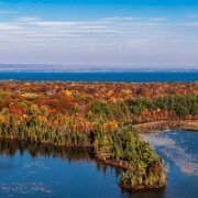
7 Fall Colors, Michigan
2011-10-11_16-25_16273_WTA_5DM2 Brimely Scenic Overlook
8 Brimely Scenic Overlook
2011-10-12_10-52_16377_WTA_5DM2 Tahquamenon Falls, Michigan
9 Tahquamenon Falls, Michigan
2011-10-12_11-07_16430_WTA_5DM2 Taqamenon Falls State Park, Michigan
10 Taqamenon Falls State Park, Michigan
WTA_IMG_2011_10_12 - 1116 - bw-2 Crisp Point
11 Crisp Point
2012-07-01_14-28_04539_WTA_5DM3 Grand Marais Harbor Panorama - Original is 19762 x 3267
12 Grand Marais Harbor Panorama - Original is 19762 x 3267
2012-07-01_15-31_04779_WTA_5DM3 Sable Falls is a waterfall located on Sable Creek in the eastern-most portion of the Pictured Rocks National Lakeshore in Alger County, Michigan. The falls...
13 Sable Falls is a waterfall located on Sable Creek in the eastern-most portion of the Pictured Rocks National Lakeshore in Alger County, Michigan. The falls tumbles 75 feet over Munising and Jacobsville sandstone formations. The waterfall is approximately one-half mile from Lake Superior.
WTA_5DM3 - 2012_07_02 - 0116-Edit-2 Pictured Rocks National Lakeshore, Michigan
14 Pictured Rocks National Lakeshore, Michigan
2012-07-02_10-13_05311_WTA_5DM3 Pictured Rocks National Lakeshore, Michigan
15 Pictured Rocks National Lakeshore, Michigan
2012-07-02_11-25_05712_WTA_5DM3 Pictured Rocks National Lakeshore, Michigan
16 Pictured Rocks National Lakeshore, Michigan
2012-07-02_11-26_05724_WTA_5DM3
17
WTA_5DM3 - 2012_08_27 - 0206-Edit-2 Cut River Bridge is a cantilevered steel deck bridge over the Cut River in the Upper Peninsula of the U.S. state of Michigan. It is located along U.S. Highway 2...
18 Cut River Bridge is a cantilevered steel deck bridge over the Cut River in the Upper Peninsula of the U.S. state of Michigan. It is located along U.S. Highway 2 (US 2) in Hendricks Township, Mackinac County, between Epoufette and Brevort, about 25 miles (40 km) northwest of St. Ignace and the Straits of Mackinac. There is a long but not often traversed wooden staircase to the valley below that was constructed some time after the construction of the bridge itself.
2012-08-27_15-20_09127_WTA_5DM3 Sable Falls is a waterfall located on Sable Creek in the eastern-most portion of the Pictured Rocks National Lakeshore in Alger County, Michigan. The main...
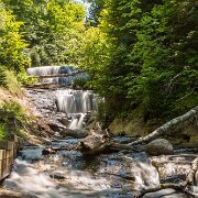
19 Sable Falls is a waterfall located on Sable Creek in the eastern-most portion of the Pictured Rocks National Lakeshore in Alger County, Michigan. The main access road to the falls is H-58 west of Grand Marais, Michigan. The falls tumbles 75 feet over Munising and Jacobsville sandstone formations. The waterfall is approximately one-half mile from Lake Superior. Stairs allow for relatively easy access to the falls. Between 2007 and 2010, the park service extended the boardwalk along the falls to include a portion of Sable Creek downstream from the major (upper) falls to allow visitors to take in the minor (lower) falls and rapids downstream.
2012-08-27_16-02_09161_WTA_5DM3 Grand Sable Dunes cover a 5-mile stretch along the southern shore of Lake Superior in the upper peninsula of Michigan in the eastern portion of the Pictured...
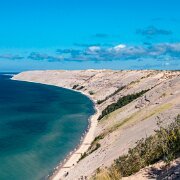
20 Grand Sable Dunes cover a 5-mile stretch along the southern shore of Lake Superior in the upper peninsula of Michigan in the eastern portion of the Pictured Rocks National Lakeshore.
Glacial melt during the last major advance/retreat called the Marquette Readvance created the conditions for the formation of the Grand Sable Banks. Dominant northwesterly winds eventually caused blowing sand to become perched on the banks. Today, the Grand Sable Banks rise to heights of up to 300 ft. at a 35 degree angle from the shore of Lake Superior. The Grand Sable Dunes perched on top of these banks offers a desolate sandscape with jack pine forest near the edges.

New images